
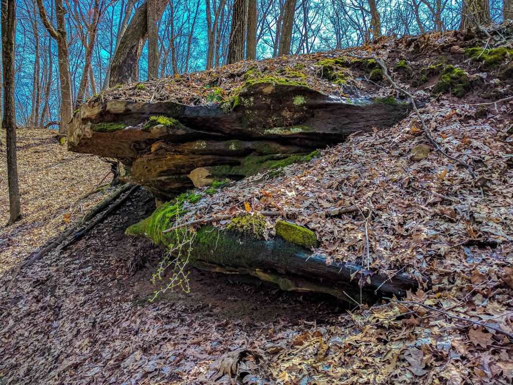
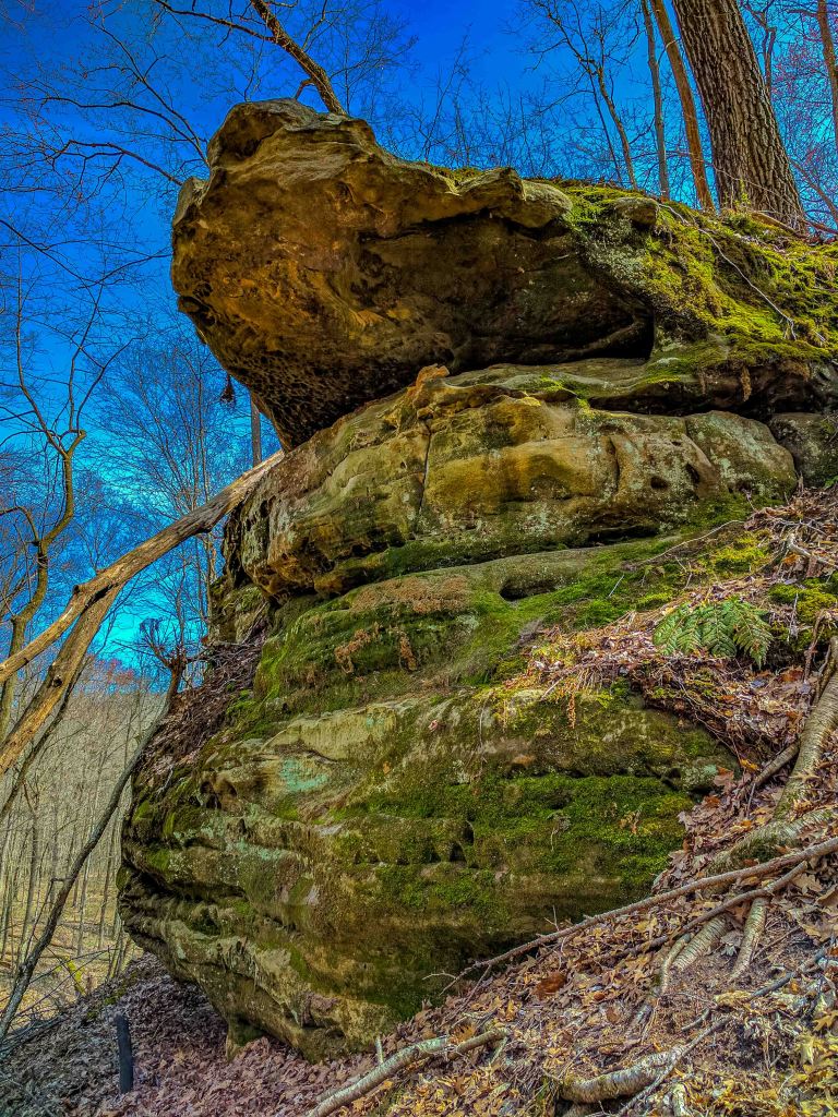
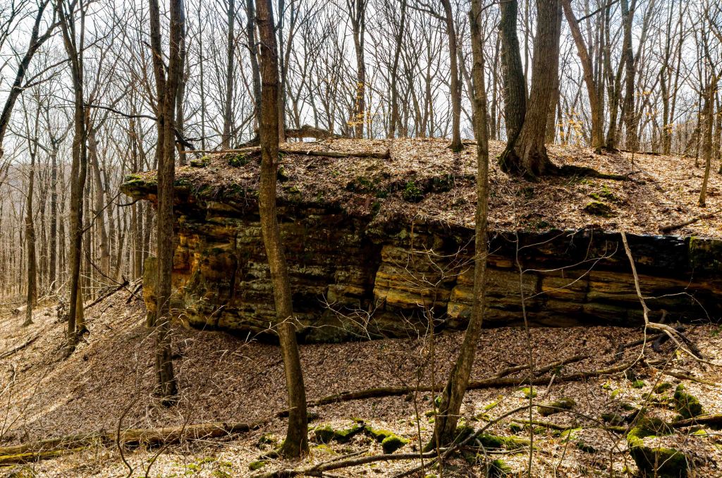
Durst Rockshelter State Natural Area features a southern mesic forest surrounding a large rockshelter carved out of a sandstone ridge. Owned by the The Nature Conservancy, the location of Durst Rockshelter will not be disclosed here. It is probably not that hard to find and permission from TNC is no longer required to visit, but more visitors is not what this place needs. I volunteered on garlic mustard pulling duty (and other invasive species removal) for several years at the site, allowing me numerous opportunities to explore, all while helping the site.
Like the previous blog entry, Muehl Springs, Durst Rockshelter is owned by The Nature Conservancy, but in contrast, has not (yet, at least) been donated to the WI DNR. The location of Durst will not be disclosed here, including any topographic or Google maps. Its location is probably not that difficult to find, but as noted, but permission used to be required to visit due to private property surrounding the natural area.
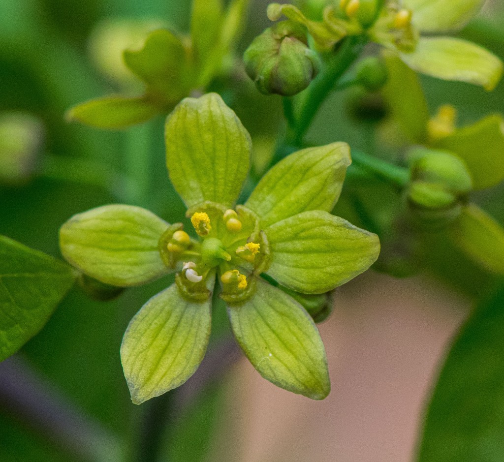
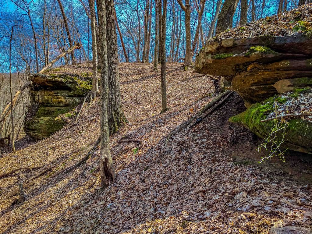
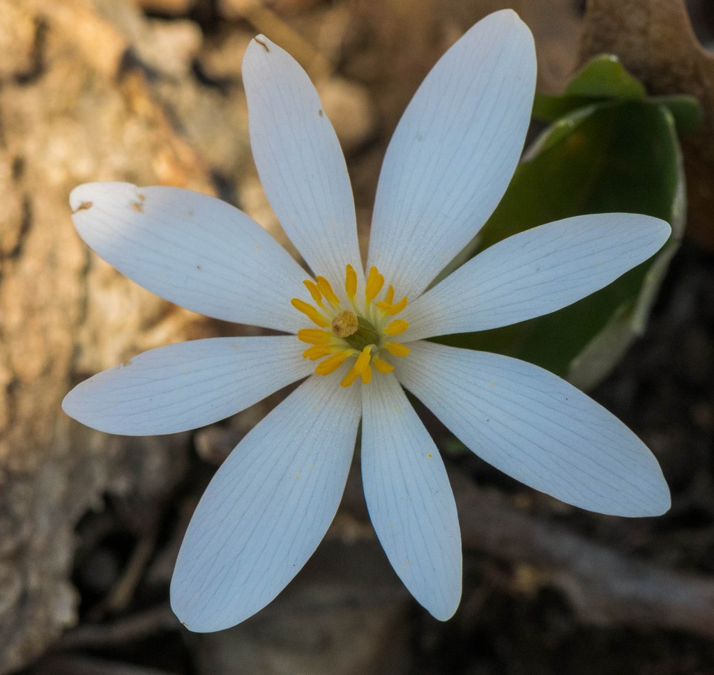
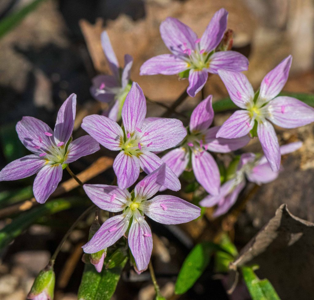
The highlight of the natural area is the rockshelter, of course. Relative to the one found at Natural Bridge State Park, the shelter seems smaller, and the rock outcropping lacks the natural arch of its more famous cousin. My forays to Durst have been as part of The Nature Conservancy’s volunteer crew of garlic mustard pullers that has been active in the area for many years. Primarily from late March to early May, they systematically work their way across the parcel in a grid search, hand-pulling every garlic mustard plant to be seen. I learned a wealth of knowledge from these wonderful folks, including how to identify garlic mustard without flowers, then how to identify first-year from second-year plants. Along the way, I’d snap photos of the emerging spring ephemerals, including bloodroot, Virginia spring-beauty, blue cohosh, cancer-root, Jacob’s ladder, various anemones, and even moisture-loving plants such as marsh marigold and skunk cabbage in the seeps. Top the day off with a smorgasboard of sandwich toppings/options and a great time was had by all.


Additional photos can be found on Flickr.
No map provided| SNA # | 44 |
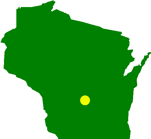
| County | Sauk |
| Natural Communities / Geology | Southern Mesic Forest, Rockshelter |
| Size (Acres) | 40 |
| Parking | n/a |
| Trails | No |
| Easy to Find | n/a |
| Best Seen By | Foot |
| Recommended Footwear | Hiking boots |
| Marked Boundaries | No |
| Ownership | The Nature Conservancy |
| Located Within | n/a |
| # Visits | 14 |

